Services
Main Services related to Exploration and Production (E&P):
Marine and Airborne Gravity and Magnetics
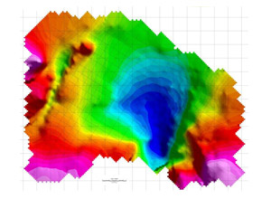
Gravity and magnetic data are essential to enhance seismic surveys with valuable additional information for the interpretation of complex geological structures.
In general seismic data has difficulty in mapping pre-salt sequences and incoherent basement. Gravity and magnetic data have the key to map basement and contribute meaningful, cost-effective information for petroleum and mineral exploration.
Gravity and magnetic surveying are passive measurements since they do not send any source signal into the ground to create a disturbance for diagnostic measurement. Due to the passive character of the signals this kind of survey is eco-friendly as well, because marine mammals or other protected species will not be disturbed by noise pollution.
Both survey methods are commonly used to locate basins filled with lower density sediments above a magnetic basement with higher density and higher magnetization. Magnetic surveys are successfully finding structurally trapped hydrocarbons above magnetic basement. Significant finds are still being made in conjunction with seismic information.
In result gravity and magnetic data assist the understanding of the petroleum prospectivity, the geological setting and the environmental significance of survey areas very efficient.
Gravity surveys have found billions of barrels of oil and trillions of cubic feet of gas above and around salt domes (Silverman, M. R., Anderson, J., Petroleum Frontiers 4/2001).
Further Services related to E&P:
- Marine Mammal Observing
- Passive Acoustic Monitoring
- Protective Species Observing
Engineering and other Services:
- Precise positioning and navigation
- Hydrographic surveys
- Sensor development
- Engineering surveys, topographical surveys
- Land registry surveys and land management
- Environmental monitoring
- Geo information
- Geoid determination
- Consulting


Gravionic GmbH
Hermann-Blenk-Str. 27+29
38108 Braunschweig
Germany
Phone: +49 531 26 25 18 4
Mobile: +49 172 8777183
E-Mail: service@gravionic.de
