Effective High Resolution Airborne Gravity by using Gyrocopter / Gyroplane
- as well as using small aircraft -
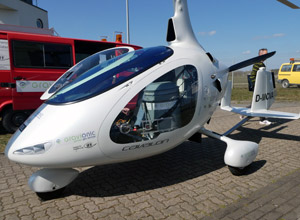
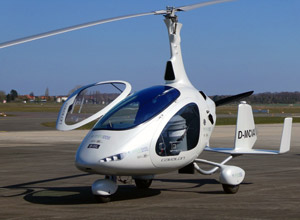
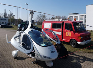
Originating from a request from the UK based company Africa New Energies Limited for an efficient high resolution airborne gravity survey in the Kalahari of Namibia by using a Gyrocopter / Gyroplane, Gravionic GmbH in collaboration with the Institute of Flight Guidance and Control (IFF, Technical University of Braunschweig) started in 2018 with the research and development works to adapt a special gravimeter system to a Cavalon gyrocopter (manufactured by AutoGyro GmbH, Hildesheim).
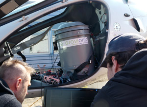
This improved gravity system developed by IFF / Gravionic is a modified Chekan-AM air/sea precision gravitymeter (manufactured by Concern CSRI Elektropribor, St. Petersburg / Russia) which is mainly based on the combination of a high-precision Russian submarine navigation system as well as a special JAVAD-GNSS receiver (provided and supported by ALLAST GmbH, Hannover) and radar-altimeter (manufactured by s.m.s, smart microwave sensors GmbH, Braunschweig). After around 20 months of research and development and thanks to significant government funding provided by ZIM (a funding programme of the German Federal Ministry for Economic Affairs and Energy), on 07th of April 2020 the first test flight with this brand new system was conducted successfully.
Compared to traditional airborne gravity systems based on larger twin-engine airplanes, this new survey system is able to fly at low altitudes (e.g. 10 to 30 meter above the ground) at a very slow speed (50 to 80 km/h). This `low and slow` capability is the key to enable outstanding high resolution airborne gravity results. Furthermore the Cavalon gyrocopter provides a remarkable flight time of about 4 hours, and - as a characteristic of every Gyrocopter / Gyroplane - it can land safely and slowly even should the motor fail.
In conclusion, safe high resolution airborne surveying is now available at a fraction of the cost compared to traditional airborne platforms like twin-engined aircraft or helicopters. Furthermore due to the portable concept and design of the gravity system it is also possible to install it in other gyrocopters as well as in other small aircraft. Combined with state-of-the-art magnetics this system will enable extremely effective high resolution airborne geophysics sensing to detect new natural resources.
Thanks to ZIM's funding, and intensive cooperation of project partners (ANE, IFF, Gravionic) as well as the enthusiastic and very supportive gyrocopter manufacturer AutoGyro, we are now also looking forward to other meaningful projects related to airborne remote sensing using gyrocopters, light aircraft as well as special types of drones.
May 2020
Contact: Ralf Heyen, CEO. ralf.heyen@gravionic.com
Related Links
- Africa New Energies Limited
- Institute of Flight Guidance, IFF
- AutoGyro GmbH
- Concern CSRI Elektropribor
- ALLSAT GmbH
- s.m.s, smart microwave sensors GmbH
- ZIM
- Download PDF with high resolution photos
Copyright banner photography (Cavalon in front of sunset): AutoGyro GmbH
Gravionic GmbH
Hermann-Blenk-Str. 27+29
38108 Braunschweig
Germany
Phone: +49 531 26 25 18 4
Mobile: +49 172 8777183
E-Mail: service@gravionic.de
